Overview
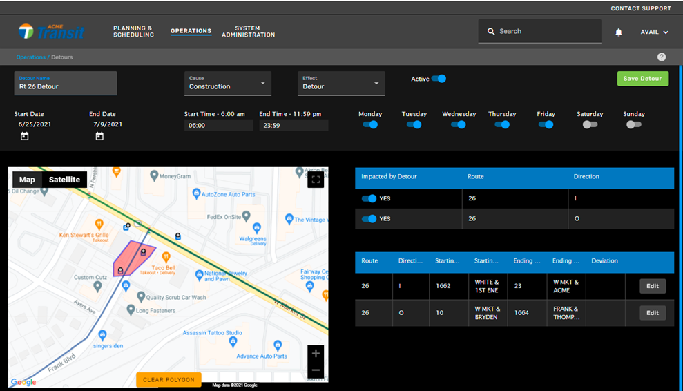
After completing the top fields, you must define the detour area by drawing a polygon on the map. The map area includes tools and options to make this task easier.
Use the zoom control buttons on the map, or the mouse wheel, to first locate the required area:

Use the view control to switch between Map and Satellite views:

Other display options in the map area include the following:
- Display labels on the satellite
- Choose the full-screen option in the upper-right.
- Use the zoom control and street view options in the lower-right.
To create a polygon, start by using the zoom in/out feature to locate the area needed at the ‘street level’. Then single-click on the map where you want to add the first point. Click on the map again, to end the first line segment. Each additional click adds a new point in the polygon. Finally, click when the cursor changes to the finger near the first point or double-click at any point to close the polygon.

If a user tries to save a detour without drawing a polygon or drawing a polygon that doesn't affect any route segments, the following error will come up.